 NSW Geoscience Metadata
25000
Type of resources
Available actions
Topics
Keywords
Contact for the resource
Provided by
Years
Formats
Representation types
Update frequencies
status
Scale
-

Depth to the Lithosphere–Asthenosphere Boundary (LAB) modelled by Geognostics with support from government, academia and industry. The LAB surface is the base of the ridgid lithosphere and the top of the ductile asthenosphere. In geothermal terms it marks a thermal and mechanical tranisition in the Earth at a temperature of 1330 °C. This surface is modelled using themal modelling (mantle heat flow, crustal heat production, thermal conductivity, Moho depth and lithospheric structure) seismic tomography, magnetotellurics, global and regional geodynamic models and tectonic context.
-
In 2016, the Geological Survey of NSW (GSNSW) published a state-wide depth to basement 3D model (Robinson 2016, 2017). Since then, new geological and geophysical data have been released and used for the construction of basin-scale 3D geological models for the southern Thomson Orogen and the Sydney, Gunnedah and Bowen basins (Davidson 2019; Oliveira and Davidson 2019; Oliveira et al. 2019). The basement topography under these regions was modelled using constraints from drillholes, seismic, Seamless Geology, magnetics and gravity data. The results have now been incorporated into the updated Statewide 3D Basement Elevation Model reported herein.
-

Basement type interpreted by Geognostics with support from government, academia and industry. The basement type describes the geological processes that has produced each basement block
-
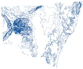
Depth contours derived from the NSW Basement Elevation Model.
-

Total heat flow at surface model (2023) created by Geognostics with support from government and industry. This model is the sum of all heat-flow contributions (mantle heat flow, lower crustal heat flow, upper crustal radiogenic heat flow and sedimentary heat flow). This is modelled using a bottom up approach starting from the mantle and calculating upwards: Qtotal = Qmantle + Qlowercrust + Qupper crust + QSediments Basement composition and terranes dominate total heat flow, especially where sediment cover is thin. Where sediments are thick then these sediments mute the basement signatures. The total heat flow patterns closely follow upper crustal radiogenic heat production.
-
In 2023, the Geological Survey of NSW (GSNSW) engaged Geognostics to perform a review and update of the previous OZ SEEBASE 2021. Previous SEEBASE® studies of NSW basins undertaken by Frogtech Geoscience were undertaken over 15 years ago, and significant new data have been acquired since that time (drillholes, gravity, magnetics, seismic, etc.), along with on-going research and consolidation of statewide interpretations undertaken by the Geological Survey of NSW (GSNSW; i.e., the Seamless Geology Map of NSW by Colquhoun et al., 2022).
-
The Geological Survey of NSW developed a Seamless Geology of UTM Zone 56 during2014 as part of a project to develop a seamless vector geology dataset of the best available geological mapping data covering the whole of NSW.The overarching aims of the Statewide Seamless Geology Project were to: (i) compile the different original scales, formats and rock unit naming conventions into a consistent, statewide format; (ii) edge-match the geology across existing map sheets; and (iii) interpret the basement geology under cover. The resulting geodatabase comprises a series of layers which include: (i) solid basement geology; (ii) cover rocks (defined as undeformed and unmetamorphosed); (iii) Mesozoic igneous rocks; and (iv) Cenozoic sedimentary and igneous rocks. The project was divided into 3 major stages corresponding to the UTM zones which divide New South Wales. This dataset includes the seamless geology layers from the NSW portion of UTM Zone 56 (ie.east of 150 degrees longitude to the coast).
-
This map layer shows the locations of in-stream water monitoring stations used by coal mining companies to monitor water quality in the Upper Hunter catchment. This information is provided by the coal companies as part of the Upper Hunter Mining Dialogue in cooperation with NSW Minerals Council and the community. A different coloured symbol is used for each coal company.
-
Recent exploration results, in the form of drilling intercepts and resource figures, are presented along with resource figures for operating mines on this map. The information is sourced from selected exploration results and resource calculations published in company reports available to the public.
-

Depth to the Mohorovičić discontinuity (Moho) interpreted and modelled by Geognostics with support from government and industry. The Moho surface is the boundary between the Earth's crust and the upper mantle. The depth to moho is a representation of the thickness of the Earth's Crust. This moho surface is derived from seismic, gravity and other geophysical datasets.