 NSW Geoscience Metadata
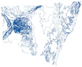
NSW Statewide SEEBASE 2023 Contours
In 2023, the Geological Survey of NSW (GSNSW) engaged Geognostics to perform a review and update of the previous OZ SEEBASE 2021. Previous SEEBASE® studies of NSW basins undertaken by Frogtech Geoscience were undertaken over 15 years ago, and significant new data have been acquired since that time (drillholes, gravity, magnetics, seismic, etc.), along with on-going research and consolidation of statewide interpretations undertaken by the Geological Survey of NSW (GSNSW; i.e., the Seamless Geology Map of NSW by Colquhoun et al., 2022).
Simple
- Date (Publication)
- 2024-08-15
- Edition
-
1
- Purpose
-
Define a robust geological model and foundational dataset to improve understanding and management of NSW’s minerals, energy and groundwater resources.
- Status
- On going
- Maintenance and update frequency
- As needed
- Theme
-
-
3D model
-
NSW Geology
-
NSW basement topography
-
- Access constraints
- License
- Use constraints
- License
- Other constraints
-
CC-BY-4.0
- Spatial representation type
- Vector
- Denominator
- 25000
- Metadata language
- English
- Character set
- UTF8
- Topic category
-
- Geoscientific information
- Begin date
- 2024-08-13
- End date
- 2024-08-13
))
- Reference system identifier
-
EPSG: 3308
- OnLine resource
-
Download zipped shape file
(
WWW:DOWNLOAD-1.0-http--download
)
- Hierarchy level
- Dataset
- File identifier
- 7ae77ee3-6acc-40d0-a8af-5bb84c1162de XML
- Metadata language
- English
- Character set
- UTF8
- Date stamp
- 2024-08-15T18:07:38
- Metadata standard name
-
ISO 19115:2003/19139
- Metadata standard version
-
1.0
Overviews
Spatial extent
Provided by
