 NSW Geoscience Metadata
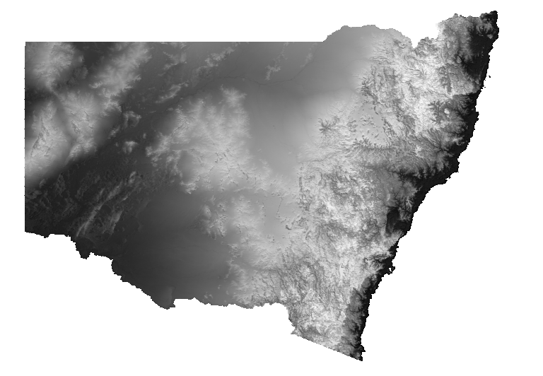
NSW Elevation Greyscale
Elevation is a greyscale layer with a histogram-equalised colour stretch. Cooler colours indicate lower values and warmer colours represent increasingly higher elevation. Elevation is derived from 5 metre LiDAR coverage of NSW and has been resampled to a uniform 25 metre grid cell size.
Simple
Identification info
- Date (Revision)
- 2023-03-03T00:00:01
- Status
- Completed
- Topic category
-
- Geoscientific information
N
S
E
W
))
- Keywords (Theme)
-
- WCS
- ImageMosaic
- DEM
Distribution Information
- Distribution format
-
- OnLine resource
- Download DEM 2022 ERS file
- OnLine resource
- Download DEM 2022 TIF file
Resource lineage
- Statement
- Elevation (in metres above sea level) is derived from elevation data acquired during airborne magnetic and radiometric surveys. Elevation is calculated by subtracting the ground clearance from the GPS altitude. Numerous surveys have been flown over NSW. For each survey an elevation grid is generated and merged with to create a statewide DEM. In regions with gaps, shuttle radar (SRTM) has been used.
- Hierarchy level
- Dataset
Reference System Information
- Reference system identifier
- EPSG:4326
Reference System Information
- Reference system identifier
- CRS:84
Metadata
- Metadata identifier
- urn:uuid/41a66168-17d4-477b-85b0-8fcdf64523f9
- Language
- English
- Character encoding
- UTF8
Type of resource
- Resource scope
- Dataset
- Metadata linkage
- https://geonetwork.geoscience.nsw.gov.au/geonetwork/srv/api/records/41a66168-17d4-477b-85b0-8fcdf64523f9
- Date info (Revision)
- 2024-05-09T17:04:16
- Date info (Creation)
- 2020-08-03T16:08:37
Metadata standard
- Title
- ISO 19115:2003/19139
- Edition
- 1.0
Overviews
geophys-imagery-geophys-dem-25m-greyscale.png
Spatial extent
N
S
E
W
Provided by

Associated resources
Not available