 NSW Geoscience Metadata
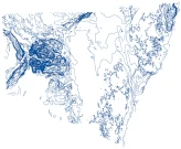
NSW Geology
Type of resources
Available actions
Topics
Keywords
Contact for the resource
Provided by
Years
Representation types
Update frequencies
status
Scale
-
Depth contours derived from the NSW Basement Elevation Model.
-
In 2016, the Geological Survey of NSW (GSNSW) published a state-wide depth to basement 3D model (Robinson 2016, 2017). Since then, new geological and geophysical data have been released and used for the construction of basin-scale 3D geological models for the southern Thomson Orogen and the Sydney, Gunnedah and Bowen basins (Davidson 2019; Oliveira and Davidson 2019; Oliveira et al. 2019). The basement topography under these regions was modelled using constraints from drillholes, seismic, Seamless Geology, magnetics and gravity data. The results have now been incorporated into the updated Statewide 3D Basement Elevation Model reported herein.
-
In 2023, the Geological Survey of NSW (GSNSW) engaged Geognostics to perform a review and update of the previous OZ SEEBASE 2021. Previous SEEBASE® studies of NSW basins undertaken by Frogtech Geoscience were undertaken over 15 years ago, and significant new data have been acquired since that time (drillholes, gravity, magnetics, seismic, etc.), along with on-going research and consolidation of statewide interpretations undertaken by the Geological Survey of NSW (GSNSW; i.e., the Seamless Geology Map of NSW by Colquhoun et al., 2022).
-
In 2016, the Geological Survey of NSW (GSNSW) published a state-wide depth to basement 3D model (Robinson 2016, 2017). Since then, new geological and geophysical data have been released and used for the construction of basin-scale 3D geological models for the southern Thomson Orogen and the Sydney, Gunnedah and Bowen basins (Davidson 2019; Oliveira and Davidson 2019; Oliveira et al. 2019). The basement topography under these regions was refined and the results have now been incorporated into the updated state-wide depth to basement 3D model reported herein.
-
The 3D geoscience project aims to generate 3D models of lithological and structural aspects of basin and orogenic provinces at scales ranging from broad to site-specific. The models have applications in land-use management, civil engineering, water resource management, waste management, mineral and energy resource exploration and research.