 NSW Geoscience Metadata
Boundaries
Type of resources
Available actions
Topics
Keywords
Contact for the resource
Provided by
Years
Formats
Representation types
Update frequencies
status
Scale
-
Map blocks and map units are based on a system originally devised by the British Ordinance Survey. Each 1:1 million scale map sheet is subdivided into 3456 graticular map blocks, each measuring 5’ of latitude by 5’ of longitude. These map blocks are further subdivided into 25 1’ by 1’ map units. A map unit is approximately 3 square kilometres in size. Map blocks and map units are used in New South Wales to define certain types of titles. Petroleum exploration titles (PELs) are applied for and granted as a series of map blocks (Map sheet, block number), and mineral exploration titles, which tend to be smaller in size, are defined as a list of map units.
-
The Competitive Allocation Pathway is designed to maximise the value of a suitable unallocated coal resource through a competitive process. The Department of Regional NSW’s (Regional NSW) Guideline for the Competitive Allocation of Coal (December 2020) sets out when the Competitive Allocation Pathway applies.
-
This vector contains the boundary and flight lines of Infill Area D. Infill Area D is part of the MinEx Collaborative Research Centre (CRC) Cobar Airborne Electromagnetic (AEM) survey. This survey was a collaboration between the Geological Survey of NSW (GSNSW) and Geoscience Australia. Infill D was funded by Legacy Minerals Pty. Ltd. Regional lines were funded by GSNSW.
-
Map blocks and map units are based on a system originally devised by the British Ordinance Survey. Each 1:1 million scale map sheet is subdivided into 3456 graticular map blocks, each measuring 5’ of latitude by 5’ of longitude. These map blocks are further subdivided into 25 1’ by 1’ map units. A map unit is approximately 3 square kilometres in size.
-
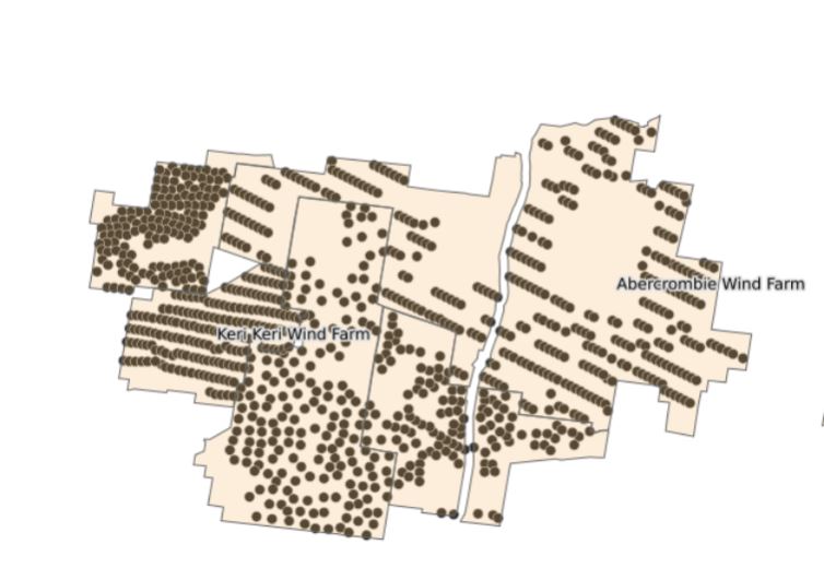
Wind farms dataset displays the location of wind farms in NSW. Wind Farms contain wind turbines, which can be up to 200m tall.
-
The Governor of NSW can create Mineral Allocation Areas (MAAs) for any mineral group under the Mining Regulation 2016. These areas prevent new exploration licence applications for the affected mineral group(s) in the area without Ministerial consent. Reporting and renewal requirements for existing mineral titles within each MAA are unaffected.
-
Survey Pegs used to mark out Mineral Claims in the Lightning Ridge and White Cliffs areas of NSW, Australia.
-
Fossicking is the small scale search for and collection of minerals, gemstones or mineral bearing material from the surface (or by digging from the surface) with handheld instruments. This activity may only be undetaken for recreational, tourist or educational purposes. Section 12 of the Mining Act 1992 and Clause 12 of the Mining Regulation 2010 define fossicking as a lawful activity, to be carried out according to the required regulations. Fossicking is generally pemitted to take place on any land, provided permission is obtained from the landowner or land manager, except in National Park and other excepted areas according to the Act. To fossick in State Forest areas a special permit is required.Within a fossicking district, a person can go onto an exploration licence for the purpose of fossicking without the licence holder's consent, provided they have the permission of the landholder. A fossicking district may cover a small area, or an entire Local Government Area (LGA).
-
Pending mineral claims granted under Part 9, Division 4, Section 190 of the Mining Act 1992 No 29.
-
The NSW Government has clearly identified areas where higher priority land uses mean that coal mining cannot occur. For the State Significant Development application SSD5156 - Rocky Hill area, the prohibition will apply to open cut mining only. Otherwise, within this area coal mining will be prohibited by State Environmental Planning Policy.